
Developed by researchers at Glasgow University, the system is based on data drawn from accounts of how people in the real world behaved after finding themselves lost in their landscape. It then models the actions of simulated ‘agents’ lost in a particular environment, creating a heat map of where people are likely to end up. The Glasgow team believes the system could allow search and rescue efforts to better focus their efforts on certain locations. The work is published in IEEE Access.
Related content
“Search and rescue teams perform vitally important lifesaving work, despite being frequently under-funded and often being crewed by volunteers,” said lead researcher Jan-Hendrik Ewers, from Glasgow University’s James Watt School of Engineering.
“Initially, as part of my PhD, I set out to see whether it would be possible to use machine learning to train a new type of search and rescue system to predict where lost hikers might be found. However, machine learning requires a vast amount of information to draw its conclusions.
“That led my colleagues and I to consider whether we could tap into existing research on the behaviour of missing people which aims to understand their choices about where they went and why. Using that as the basis for these simulated agents has given us some really encouraging results.”
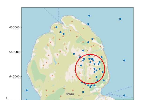
The system also took into account data gathered on missing peoples’ likelihood of being found in different types of terrain, as well as the distances people typically travelled from their reported last known location. To validate the model, AI agents were set loose from locations dotted across a digital recreation of Isle of Arran, with the results suggesting the behaviour of the agents is an accurate reflection of actual lost people’s behaviour.
“One of the advantages of this kind of psychological modelling approach to locating missing people is that it could potentially be applied to any landscape,” said co-author Dr David Anderson. “That means it could help search and rescue teams around the world, no matter if they’re working in the mountains, jungles, or deserts.
“We’re keen to explore the possibility of applying this technique to our ongoing efforts to realise the full potential of drones for search and rescue missions. Further development work and validation will be required before it could be used in real-world situations, but this is a promising early demonstration of the effectiveness of this kind of modelling and mapping.”


Deep Heat: The new technologies taking geothermal energy to the next level
No. Not in the UK. The one location in the UK, with the prospect of delivering heat at around 150°C and a thermal-to-electrical efficiency of 10-12%,...