
Known as FireSat, the low Earth orbit (LEO) constellation will deliver high-resolution imagery that updates every 20 minutes. AI will then be used to process the images, providing near real-time information about the location, size and intensity of early-stage wildfires. Backed by $13m of Google funding, the collaborative project is set to launch the first satellite of the constellation in early 2025.
“FireSat is a programme that we started with satellite experts and a number of non-profits,” said Chris Van Arsdale, leader of Google Research’s Climate & Energy group.
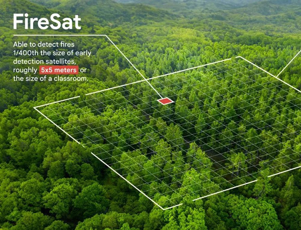
“It will be a new constellation of satellites in low Earth orbit, able to see the whole globe every fifteen to twenty minutes and spot a fire, both when it starts and for its full evolution.”
Wildfire early detection device wins UK Dyson Award
Lancashire Fire and Rescue test Windracers’ drones for wildfire prevention
Wildfire warriors: the latest developments in aerial firefighting technology
As part of the project, Google research worked with Muon Space and the Environmental Defense Fund to develop custom infrared sensors. The team flew the sensors over controlled burns to validate the fire detection model and establish a baseline dataset for the AI. Once FireSat is operational, it will use that baseline to rapidly compare any 5x5 metre spot on Earth with previous imagery, while also taking into account factors like nearby infrastructure and local weather to determine if there's a fire.
“We realised one of the main issues was that there just wasn't a lot of good data for how fires spread or where they even were half the time,” said Var Arsdale. “Because in a satellite image of the Earth, there's a lot of things that can be mistaken for a fire: clouds, reflecting sunlight…something that's hot, like a smokestack, all these things can look like a fire, especially when you're looking at a relatively coarse pixel.
“You realise, if we can pair satellites with machine learning, artificial intelligence was the perfect platform to generate real time operational intelligence and fires. So we designed and built the camera in order for machine learning phased fire detection.”
FireSat’s data will also be used to create a global historical record of fire spread, helping researchers to better model and understand wildfire behaviour. This builds on Google’s existing work on fire simulation in partnership with scientists in the US Forest Service.


Deep Heat: The new technologies taking geothermal energy to the next level
No. Not in the UK. The one location in the UK, with the prospect of delivering heat at around 150°C and a thermal-to-electrical efficiency of 10-12%,...