With advances in technology, drones are now being utilised to fulfil tasks from inspecting wind turbines to supporting the healthcare sector with delivery of medical supplies. The government-funded Future Flight Challenge has seen activity within the BVLOS (Beyond Visual Line of Sight) drone space flourishing, as companies aim to accelerate their integration and unlock benefits in productivity, sustainability and beyond.
A 2022 PwC report, ‘Skies Without Limits 2.0’, estimates that drones could contribute £45bn to the UK economy by 2030. It envisions that more than 900,000 drones could be operating in the UK’s skies with a potential for £22bn in cost savings and a 2.4 million tonne reduction in carbon emissions.
During the 2023 annual ARPAS-UK (the UK’s drone industry trade association) conference, Gordon Baker, a policy advisor at the government’s Department for Science, Innovation and Technology said that whilst we can’t guarantee these numbers, this is where the potential is should we get ‘very full adoption of all the capabilities’.

“There is a range of different use cases for drones…I think some of that breadth of opportunity is also part of the complexity and challenge that we’re facing,” Baker said during the event, commenting on the different technologies and use cases that the Civil Aviation Authority (CAA) is ‘inundated’ with applications for.
“There [are] an awful lot of places of work where drones have become a business-as-usual capability in a lot of spheres, and that’s something we should be proud of – because five or six years ago that certainly wasn’t the case,” he added.
“There’s definitely a rising tide of enthusiasm and support for drones, but there’s still some work to do.”
As Baker highlighted, a huge amount of this work revolves around the CAA’s role. Regulations need to be established so these technologies can operate without creating hazards for other airspace users and those on the ground.
This involves working with drone operators on testing, guidance and informing how new policies should work. Callum Holland, transformation manager on the GA & RPAS team at the CAA spoke about measures being taken at the ARPAS conference, including introducing a recognised competency like the GVC (General Visual Line of Sight Certificate) for BVLOS operations by 2024.
Unlike Visual Line of Sight drones, whereby the operator is always in sight of the aircraft – making applications limited – BVLOS drones are flying where they cannot be seen, so ensuring their safe operation is even more vital.
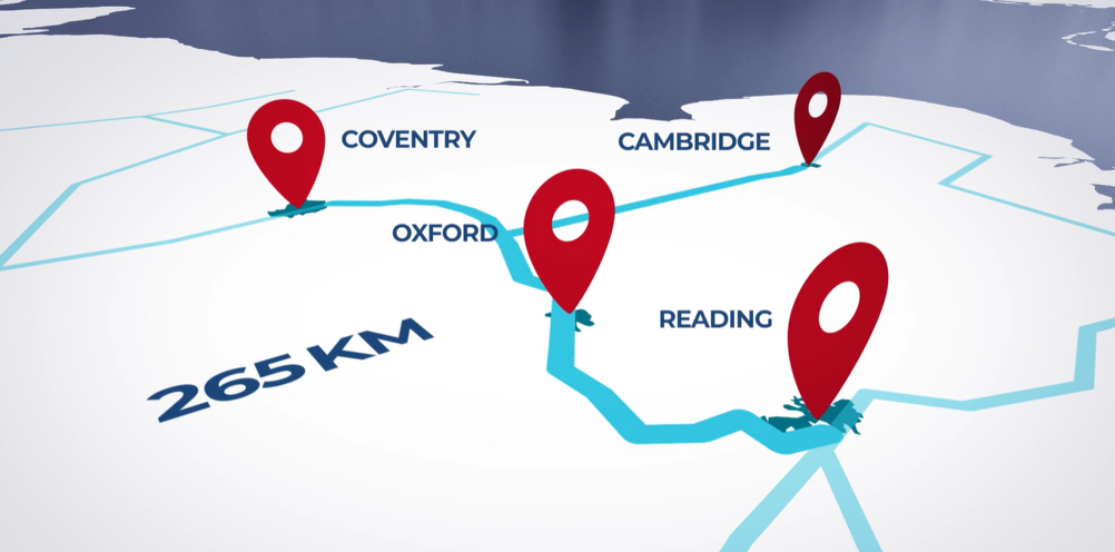
Altitude Angel, an aviation technology company that provides drone and air traffic management solutions, wants to play a key role in this. The company is heading up a consortium set to develop 165 miles (265km) of ‘drone superhighways’ in the UK, connecting airspace above Reading, Oxford, Milton Keynes, Cambridge, Coventry and Rugby over the next 18 months.
“The trouble is, as soon as you take the pilot off the aircraft and become a drone, how do we ensure that that drone is behaving like somebody’s on board?” said Phil Binks, head of air traffic management at Altitude Angel.
“You can have incredibly sophisticated, incredibly expensive drones with all the appropriate sensors on board to detect everything that’s going on around it - however it becomes very big, very heavy, very expensive, and a lot of these things are operated using battery power. All those sensors use a lot of battery power and therefore it limits the use of the drone.”
An alternative, he says, is taking the sensors off the drone and using a ground-based ‘detect and avoid’ system to monitor the airspace and pass control instructions to the drones under control of the company’s UTM (unified traffic management) service.
This is the basis of Project Skyway, for which Altitude Angel is working closely with BT alongside other consortium partners. Utilising the company’s ‘Arrow’ technology concept, whereby multiple sensor arrays come together to provide situational awareness of what is happening in the airspace, the plan is to establish the technology across 29 masts along the 165-mile corridor.

BT’s role is key – Binks explained that Altitude Angel will use their existing towers across the country to install the tech. The company has already set up an 8km trial corridor south of Reading. This has involved working with the CAA to have necessary technologies, such as cameras, GPS and radio frequency equipment, approved.
Once certified – the company’s goal is to have this complete by 2024 – the plan is to roll it out across the 165 miles, focusing on key areas initially depending on use cases and customer demand. One example of this is working with Coventry and Rugby hospitals to enable BVLOS drone deliveries of biological samples between the two, something that could be done in 15 minutes using drones compared with an hour in rush hour traffic, Binks said.
Whilst Binks is aware of other regions in the world which have established such corridors, they lack the economic viability and scalability of this concept, he believes. For example, a 50-mile drone corridor has been established in the US, but only sections of this can support BVLOS operations.
“They’ve put in the best part of $70m,” he said. “If you wanted thousands of miles of corridors around the country, is that economically viable? It doesn’t stack. There’s another corridor in the UK which covers about 15 miles and they’ve spent about £50m so far to try to enable this to take place. Again, this isn’t scalable - you can’t spend £50m for every 15 miles of corridor.”
In contrast, utilising existing infrastructure makes the solution scalable and more affordable – cost shouldn’t be a barrier to entry, Altitude Angel believes. Phase three of the Future Flight Challenge has put aside a total of £65m to be split across its 17 winning projects, of which Project Skyway is just one.
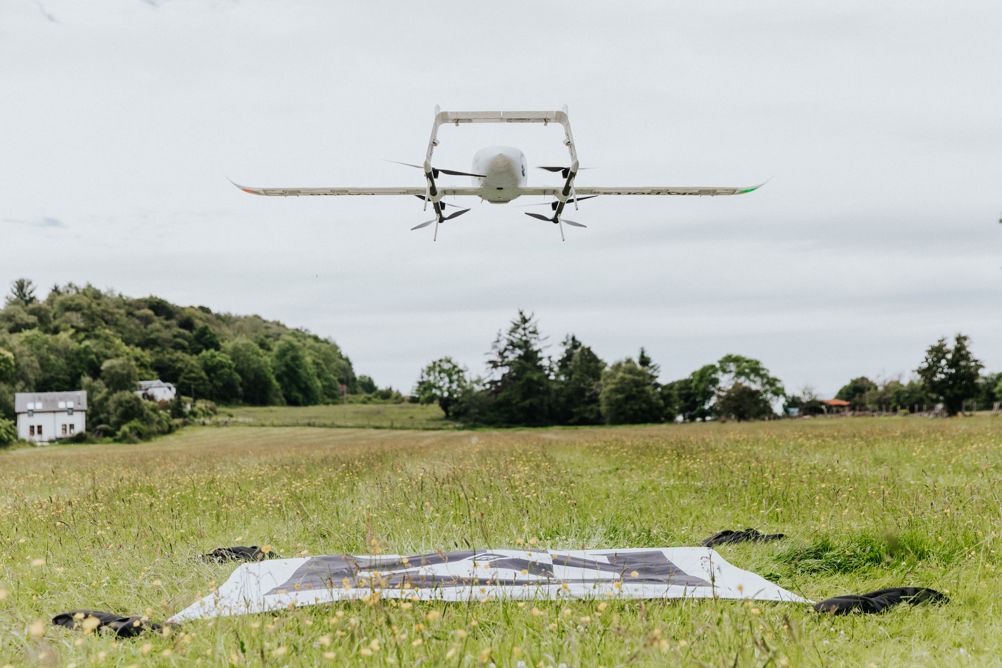
Skyports Drone Services is also a consortium member, a BVLOS drone services provider which developed its drone delivery service business initially as a secondary R&D function to the company’s primary focus – developing ‘vertiports’ for urban air transport.
Jef Geudens, head of technology, told The Engineer that the company developed a BVLOS capability and was flight testing its system just before Covid-19 hit. Skyports then had a request from the government to support Covid relief efforts in Scotland, where pathology samples were taking 3-5 days to get to the labs.
“Drones are not going to replace vans used by the NHS, but they’re really good at augmenting their capability,” Geudens said. “You can offer a better service, better reach, and really give people in really remote places the same kind of healthcare capabilities that people in cities have.”

Skyports is a part of Project CAELUS (Care & Equity – Healthcare Logistics UAS Scotland), led by a consortium aiming to develop a national distribution network using drones for transporting essential medical supplies through Scotland. The consortium has designed drone landing stations for NHS sites across Scotland and developed a virtual ‘digital twin’ model of its proposed network that aims to connect hospitals, laboratories, GP surgeries and distribution centres. Skyports will be operating CAELUS’ live flight trials, building on its previous work with the NHS on the west coast of Scotland – during a three-month project, the company trialled three routes, one 12km, one 20km and one 55km, Geudens explained.
“We flew around 40,000km BVLOS, about 450 flights during those three months, and we demonstrated that yes it works. Sometimes we can’t fly because when you have 40 knot gales battering the coast nobody can fly, but what we demonstrated was we are really good at forecasting the lulls in between different storm fronts coming in – we demonstrated that where a ferry needs about 6-8 hours to make a return trip, we only need ten or 15 minutes to go to an island and come back,” he said.
Medical deliveries isn’t the only area Skyports is exploring. In Singapore, it’s offering a ship to shore goods delivery service to vessels anchored within the port. It is also exploring BVLOS inspections over power lines and railways.
The CAA is working on an ‘atypical airspace’ framework around this, Geudens explained. If a company can demonstrate that its drones will be operating closely enough to a large obstacle such as a power line, which general aviation wouldn’t be flying close to, you can prove that you’re sufficiently separated from other air traffic and can operate safely. With these capabilities, opportunities can open in areas such as vegetation management around railways, allowing for predictive insights and helping to avoid hazards caused by trees.
“With the drones we can identify what kind of tree it is, we can forecast how quick it grows and we can forecast when we have to come and revisit in the future based on historical grow patterns,” said Geudens.
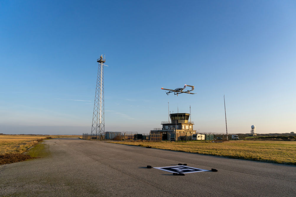
Drones can also provide welcome environmental benefits alongside a range of new, low-carbon vehicles. A project named ‘SATE’ (Sustainable Aviation Test Environment), which won the award for best aerospace project at The Engineer’s 2022 Collaborate to Innovate awards, has this sustainability focus at its core. Launched in 2020, the project has involved development of a low-carbon aviation test hub based at Highlands and Islands Airports Limited (HIAL)’s Kirkwall Airport in the Orkney Islands.
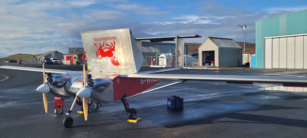
Alongside lead partner HIAL, consortium partners include the University of the Highlands and Islands, electric aircraft start-up Ampaire, BVLOS drone operator Windracers, hydrogen aircraft developer ZeroAvia, micro-drone manufacturer Flare Bright and regional airline Loganair among others. Windracers has partnered with Royal Mail as part of the project, aiming to speed up parcel deliveries using drones in the Shetland Islands, Orkneys, Hebrides and Isles of Scilly.
“Although we have a drone that flies using petrol, it is still a lot more sustainable to use our small engines to carry 100kg of payload rather than the large amounts of aviation fuel that the aircrafts that travel around the Orkneys and Shetlands use,” said Olivia Opperman, project manager at Windracers.
Windracers’ drone is a fixed-wing twin engine aircraft that can carry up to 100kg of payload. The second phase of the project, SATE2, will see the company build on successful trial flights carried out over the project’s first phase.
Last year, flights were carried out between Tingwall Airport in the Shetland Islands, and Kirkwall Airport in the Orkneys then back again, a 130-mile trip each. SATE2 will look toward connecting the Outer Hebrides and Inverness. Professor Andrew Rae, from the University of Highlands and Islands and co-founder of the SATE centre, said that from phase one the intention was always to expand.
“We started off fairly local around Kirkwall up to Shetland and across to the mainland of Wick, so this follow on programme we put together was to extend that, bring in some different types of aircraft and start to investigate some of those challenges that we found in the first phase of the project,” he said.

With one of these challenges being around regulation, the SATE team hopes that these issues will soon be smoothed out.
“The way that drones have to fly at the moment is within restricted airspace so it’s a very long and laborious process to set up these temporary danger areas, and we are working with the CAA and with HIAL on developing the next step in how drones can fly in unsegregated airspace,” Opperman said.
“These will be called transponder mandatory zones…it’s essentially where all aircraft in that particular area of airspace are transmitting their location and can see everyone else’s location. We do want to move to that next step and hopefully SATE2 will take us there.”
On the environmental side, there’s still room for improvement too. Opperman said that whilst Windracers’ drones could fly on synthetic and biofuels, this would also need to be proven with the CAA to ensure the aircraft is still flying safely.
“Synthetic fuels is the next step for us, and constantly we’re watching ZeroAvia who have a hydrogen aircraft to see how those engines develop and how we could possibly integrate that into a drone flying with hydrogen fuel cells because that would be a brilliantly green aircraft,” she explained.
Prof. Rae highlighted the importance of the collaboration between partners and the variety of the work being done.
“Because we’ve got such a variety of platforms being designed and tested there are themes, regulatory and airspace themes, that emerge. Because we’re getting real world information it’s quite useful to build up a body of knowledge that informs their policy,” he added.
“People like Loganair don’t do research every week, and universities and start-ups don’t do commercial stuff every day of the week as well so there’s a real mix of those skill sets.”
While we still may be a way off from seeing BVLOS drone deliveries become the norm, particularly in built-up urban environments where airspace is more complex, the societal benefits UAVs can bring are getting the attention of many UK businesses looking to do things differently. Challenges lie ahead, but for innovators in the space pushing the boundaries of these technologies, it seems the sky’s the limit.


Deep Heat: The new technologies taking geothermal energy to the next level
No. Not in the UK. The one location in the UK, with the prospect of delivering heat at around 150°C and a thermal-to-electrical efficiency of 10-12%,...