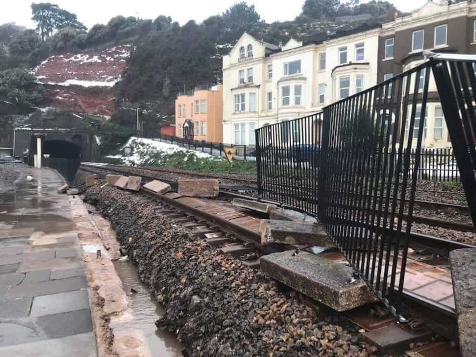
In the UK alone, there are 748,000 properties with at least a 1-in-100 annual chance of flooding, while train derailment caused by slope failure is the greatest infrastructure-related risk faced by the railways.
The cost of infrastructure failures is also high, with emergency repairs costing Network Rail ten times as much as planned works, which in turn cost ten times as much as maintenance.
The £4.8m EPSRC-funded project, led by researchers at Newcastle University, is aiming to get a better understanding of the way linear infrastructure deteriorates under increasing environmental pressures, such as more extreme weather, according to project leader Dr Stephanie Glendinning, of Newcastle’s School of Civil Engineering and Geosciences.
The research programme, Assessment, Costing and enHancement of long life Long Linear Assets (ACHILLES), involves researchers from Southampton, Durham, Loughborough, Leeds and Bath Universities, plus the British Geological Survey, infrastructure owners and consultants.
“We don’t actually know which slopes are going to fail and when, so we’re trying to identify at-risk places on the network, so that they can be pre-emptively monitored and perhaps repaired,” said Glendinning.
As part of the ACHILLES project, the researchers are investigating how soil responds to cycles of wetting and drying, to understand how slopes and bedding are affected by more periods of heavy rain, for example.
The researchers have carried out preliminary work that has shown these wet and dry cycles do reduce the strength of the soil, but hope to include surface chemistry and minerology studies to investigate further, said Glendinning.
“There could be things going on in these soils that we haven’t been looking at before, which could give us a pre-cursor to failure, so that we can then go out onto the network and look for these signs,” she said.
They also hope to use information gathered by network operators, such as data from those slopes that are already equipped with instrumentation to measure water content and pressure, and soil movement, for example.
Imaging vegetation could also reveal important clues as to what is going on under the surface of the soil, while existing measurement trains used to scan the tracks could provide useful data, she said.


Viking Link connects UK and Danish grids
These underwater links must, based on experience with gas pipelines, be vulnerable to sabotage by hostile powers. Excessive dependency on them could...